Part 5: The Top End and Red Centre …
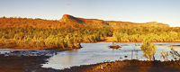
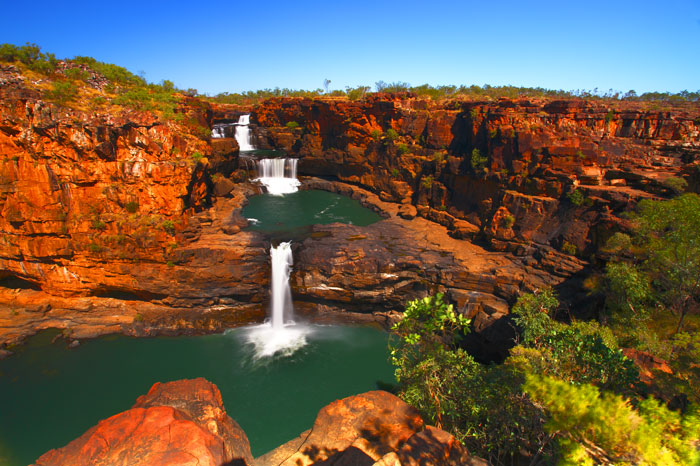
The Kimberley
 |
|
Pentecost River Crossing |
The last great wilderness: The one place left in Australia that is truly wild: The Kimberley.
 |
 |
|
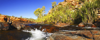
Bell Gorge |
It would have been unforgivable for us not to have chanced our little trailer on one of the most infamous roads in the country. So chance it we did.
Our journey across the Gibb River Road would certainly take its toll. Two flat tyres, a trailer with a broken suspension, ruined shock absorbers on our 4WD: And we won’t even go into all the cuts and bruises we received along the way!
The Gibb River Road is a true testimony to the harshness of this region, but nevertheless, a worth while journey in more ways than one.
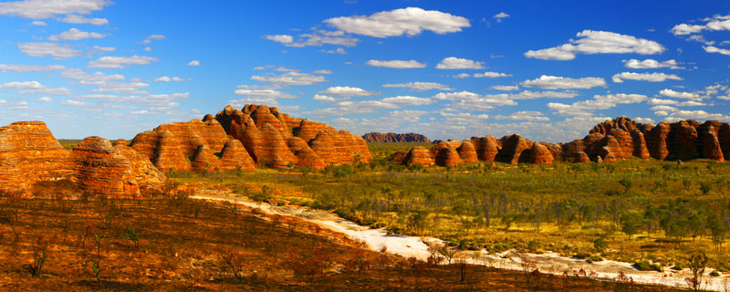
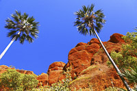
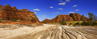
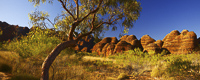
The Bungle Bungles
 |
|
The Bungle Bungles, WA |
 |
|
Echidna Chasm |
 |
 |
|
The Bungle Bungles |
The Bungle Bungles were only a recent discovery to most Australians. Unveiled in the 1980’s by a visiting film crew, these marvels have really captured the nation’s imagination. The beehive domes that form this odd landscape are dissected by the now dry river bed of Piccaninny Creek, a real display of this stark landscape.
Mornington Wildlife Sanctuary
Mornington Wildlife Sanctuary is owned and managed by the Australian Wildlife Conservatorium.
 |
|
Sir John Gorge, Mornington |
The AWC is doing a wonderful job, preserving the natural habitat and returning pastoral land back to its original state. Work at the park includes research into the endangered Gouldian Finch and Purple-Crowned Fairy Wren, as well as the study of the area's mammals, and how controlled fires can improve habitats for the inhabitants of the Sanctuary and The Kimberley.
 |
|
Fitzroy Bluff, Mornington |
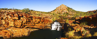
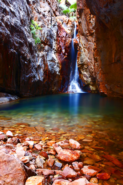
Mitchell Falls
No visit to the Kimberley would be complete without a visit to the awe-inspiring Mitchell Falls. These falls traverse four tiers, a drop of some 80 metres. An amazing sight with the river in full flow!
 |
|
Mitchell Falls |
El Questro
 |
|
El Questro Gorge |
|
 |
|
Zebedee Springs |
|
 |
|
Brancos Lookout |
|
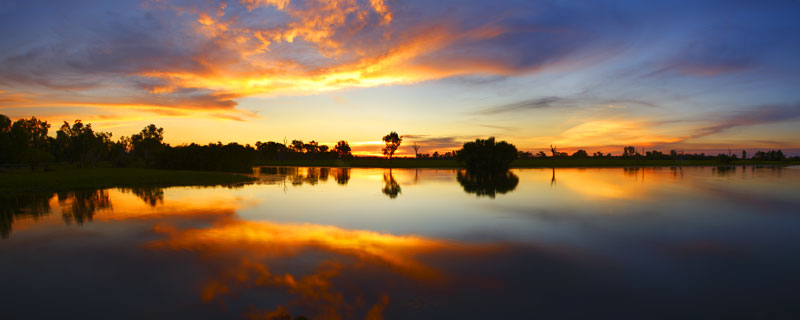
Darwin
 |
|
Mindil Beach, Darwin, NT |
 |
|
Fannie Bay, Darwin, NT |
Reaching Darwin, once again we’re able to take stock of our situation.
Having taken a pounding over the last few thousand kilometres, our 4WD was in need of a good service. A couple of new tyres and a few fixes to the trailer and we’re ready for the off.
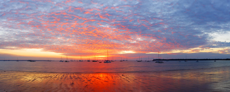
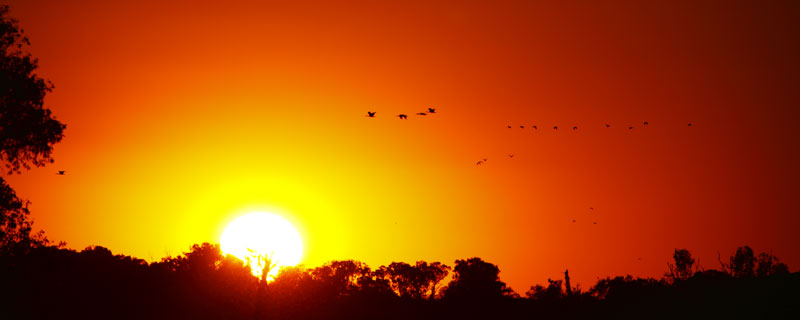
But before moving on, we also needed to sort ourselves out. A well deserved meal at Darwin’s Trailer Boat Club at Fannie Bay did the trick. Of course, straight after the meal I had to race off to photograph the sunset, a disappearing act my family has gotten used to over the last 6 months.
Kakadu National Park
From Darwin we made the short journey into Kakadu. Kakadu is one of the few areas in Australia where wetlands can be seen year round. This of course attracts wildlife in abundance. Waterbirds, including brolgas, jabirus and egrets are the norm here. Frequented by some 300 species of birds this area isn’t to be missed. Of course we mustn’t forget to mention the now familiar sight for us, the saltwater crocodile.
 |
|
Kakadu National Park |
 |
|
Yellow Water, Kakadu National Park |
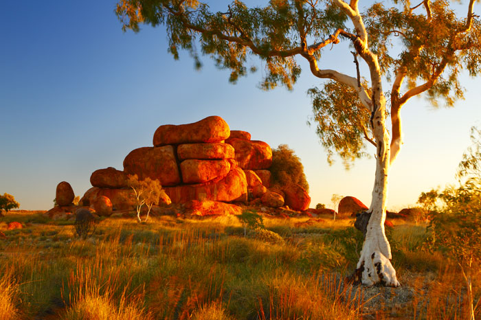
Devil's Marbles
The local aboriginal name for the Devil's Marbles is Karlu Karlu. These boulders form an area of rich cultural significance to the local people. For me this area is a place of beauty, as the rounded granite boulders make for a unique sight, sitting as they do, in a shallow valley of spinifex grasses and ghost gums.
 |
|
Karlu Karlu |
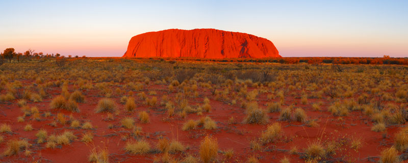
Uluru-Kata Tjuta National Park
 |
|
Uluru, NT |
Probably Australia’s most recognisable sight and outback icon is Uluru, formerly known as Ayers Rock. Rising to a height of 340 metres above the surrounding plains, the ever changing hues of the world’s largest monolith make for a magnificent sight at any time of the day. However the most popular time for photography is sunset, when the rock glows a fiery red as the sun reaches the horizon.
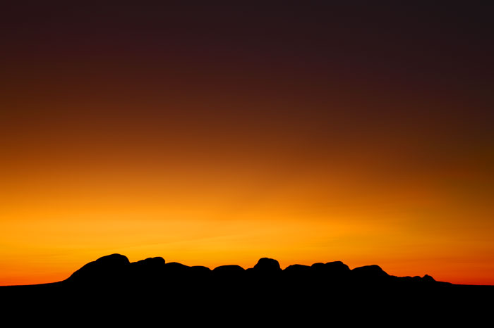
About forty kilometres from Uluru is the lesser known, Kata Tjuta. Standing at a height of 600 metres, the profile of Kata Tjuta can be seen from some distance. This makes a great silhouette image, when shot long after sunset.
 |
|
Kata Tjuta |
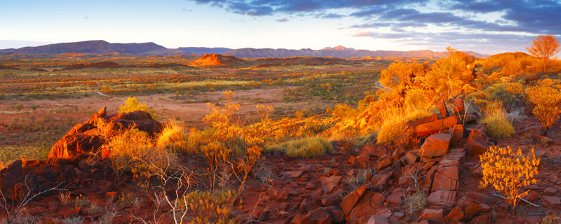
MacDonnell Ranges
One Hundred and thirty kilometres to the west of Alice Springs, the West MacDonnell Ranges are a spectacular mix of weathered rock formations, gorges and ancient river beds. The earth’s internal forces shaped this landscape over 220 million years ago, thrusting the earth’s crust into bends and folds that now make up the ranges we see today.
 |
|
MacDonnell Ranges, NT |
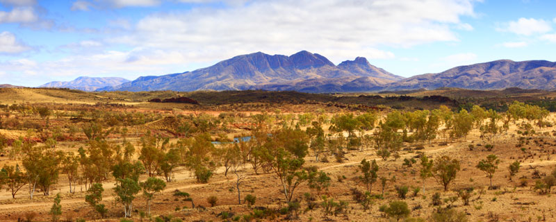
Short walks into the park's interior reveal rock formations that resemble castle ramparts with spectacular views over the landscape. The Finke River is recognised as one of the world’s oldest watercourses. I’ve used the River Red Gums that line the Finke as a fitting foreground to the magnificent peak of Mount Sonder.
 |
|
Mount Sonder, MacDonnell Ranges, NT |
It’s time now for us to make the long journey to Queensland’s tropical north coast. At 2,400 km, the journey should be an interesting one, to say the least. Let’s hope the DVD player and a stack of kid’s movies will help us all to survive the trip.
To read about the next leg of our journey, see new links on our Big Trip Homepage or receive notification via our newsletter subscription (bottom of our home page).