
Part 2: Headin' West …
Having replenished our stocks in Melbourne, it was now time to strike out west.
Our first destination, The Great Ocean Road, was built during the great depression of the 1920’s. Built to commemorate the services of soldiers and sailors who served in the Great War, it surely is a fitting tribute.
 |
|
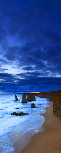
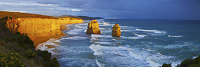
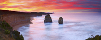
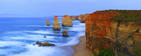
Twelve Apostles, Great Ocean Road |
 |
|
|
 |
|
|
 |
|
Twelve Apostles, Victoria |
The road winds its way along some 280 km of Victoria’s most spectacular coastline and is the gateway to Port Campbell National Park. With its rugged sandstone cliffs and limestone formations, the park is a testimony to the elements.
The Twelve Apostles has to be one of my favourite vistas in the whole of Australia. The mighty limestone pillars rise from the sea floor to a height of 50 metres above a relentless Southern Ocean. The recent loss of one of the apostles hasn’t diminished the landscape, but has served as a reminder of the power of wind and waves, even over solid rock.
The Otways
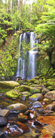
The Otway National Park forms a backdrop to this rugged coastline. Covering some 13,000 hectares, it contains lush rainforest and some of Australia’s finest waterfalls. Hopetoun and Beauchamp falls were just two of the many fern-lined falls I planned to photograph.
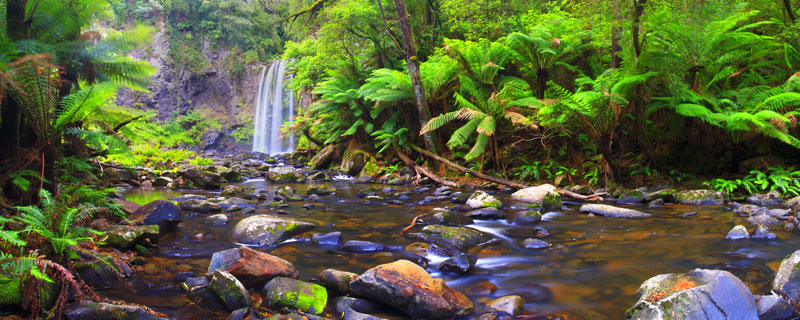 |
|
Hopetoun Falls, Victoria |
|
 |
|
Beauchamp Falls |
|
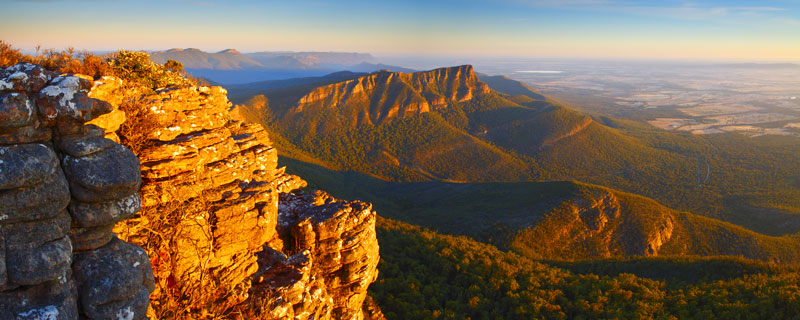
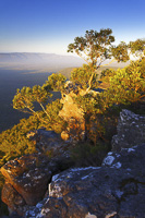
The Grampians
Venturing some 150km inland, our next destination would take us to the impressive sandstone ranges of the Grampians. Rising abruptly from the surrounding plains, they form the western-most extreme of the Great Dividing Range; a range that stretches to Cooktown in far north Queensland.
 |
|
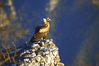
Wedge-Tailed Eagle |
The beautiful town of Halls Gap lies at the heart of the Grampians, and provided our base for the next few days. I was eager to explore the peaks of the park, as the many tracks of the area reward walkers with uninterrupted views across the plains.
With this in mind I headed out early to photograph Redman’s Bluff. To gain a vantage point I trekked to the top of neighbouring Mount William. The views from the summit made it worth the effort.
This particular morning I shared my cliff-top perch with a Wedge-Tailed Eagle. This bird is an impressive sight when viewed from afar, totally awe inspiring at close quarters.
 |
|
Redman's Bluff, The Grampians, Victoria |
 |
|
The Balconies |
The Outback
A change of scenery was now on the cards, as we travelled north into the arid outback. Our last few weeks had been spent in Victoria’s cooler climate, but now we headed for Australia’s harsher extremes. Unbeknown to us we would spend the next two weeks in forty degree heat, including one of Australia’s longest running heatwaves.
Mungo National Park
 |
|
Mungo National Park |
Our first outback location was to take in the unique Mungo National park in New South Wales’ South-western corner. Home to the lunette, known as the Walls of China, which form part of the Willandra world heritage site. Eroded from the banks of an ancient lake bed, they contain many aboriginal sites that date back over 40,000 years.
 |
|
Walls of China |
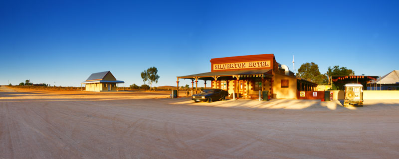
Silverton
 |
|
Silverton hotel |
 |
|
Silverton |
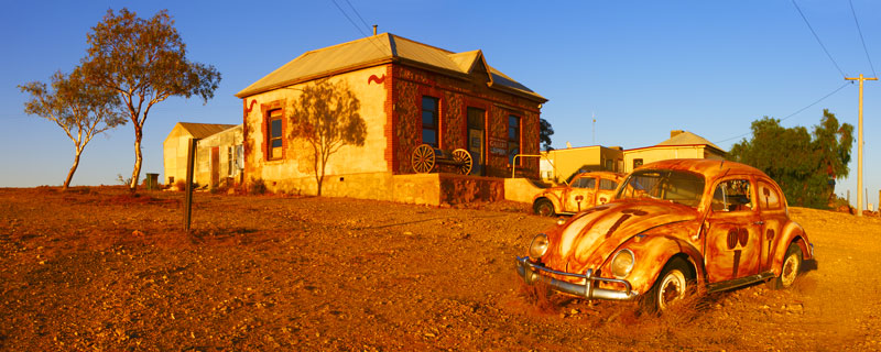
Flat treeless plains, red earth and beautiful light have inspired many an artists to move to the area around Broken Hill and Silverton. It was for the same reasons we too came to the area.
The town of Silverton sprang up in the 1880’s during the gold rush era. Finds at mines such as ‘Daydream’ brought prospectors here in their droves hoping to unearth their fortune. It was only when a downturn in the local mines and the discovery of huge amounts of silver at the now famous Broken Hill, that Silverton faded into a mere shadow of its former self.
The town was moved house by house to Broken Hill, leaving just the more permanent buildings. Now the towns few remaining buildings house the galleries of local artists, museums and the local watering hole.
Silverton has been the feature of many movies and TV commercials and the walls of the pub are awash with memorabilia. Even Mad Max’s car can be seen parked out the front. A visit to Silverton wouldn’t be the same without a cold beer at the Silverton hotel.
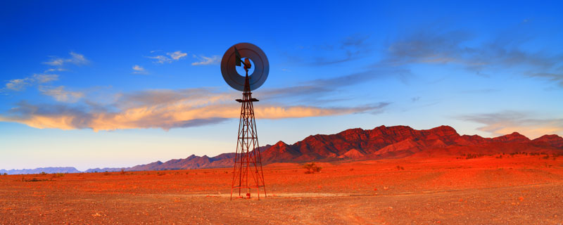
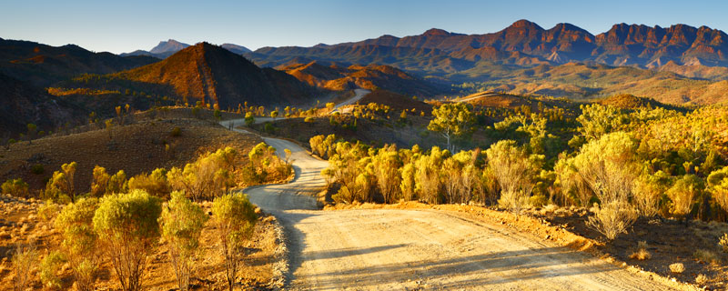
Flinders Ranges
Mathew Flinders was the first European to sight these ranges back in 1802. It wasn’t until Edward John Eyre opened up the area for settlement some 40 years later that pioneers ventured into the region. Now the ranges form a magnificent National Park with Wilpena Pound at its heart.
 |
|
Wilpena Pound, Flinders Ranges, SA |
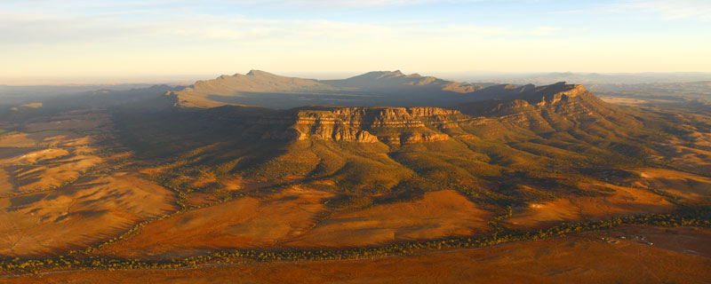
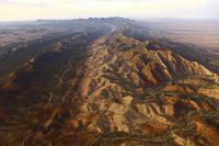
Wilpena originates from the aboriginal name for ‘cupped hand’ which is an apt description for this natural amphitheatre. The Pound is some 5km wide and 15km in length, dimensions that can only be truly appreciated from the air.
 |
|
Wilpena Pound |
 |
|
Bunyeroo Gorge |
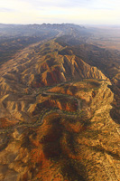
So, climbing aboard Air Wilpena just after sunrise was the only way to go. With the doors of the plane removed for a clearer view, a half hour flight around the Pound left me breathless. Aerial photographs really show off the sheer scale and rugged beauty of this region. Also the gorges that run to the north of the Pound and through the Heysen Range make for a magnificent sight.
Rough roads skirt the perimeter of the Pound and through the many gorges of the area. The views over Bunyeroo Gorge are a sight to behold at first light and the walls of the Pound itself glow a multitude of red hues as the sun rises above the horizon.
 |
|
Heysen Range |
 |
|
Brachina Gorge |
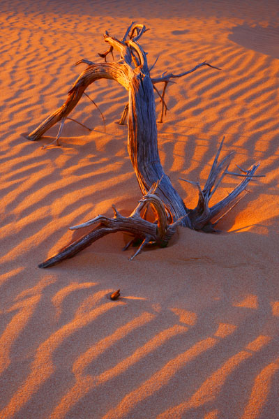
Nullarbor Plain
 |
|
Eucla Dunes |
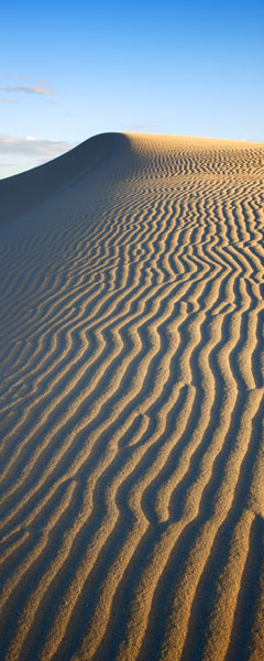
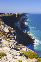
For us, our route into Western Australia would mean a trip over the vast Nullarbor Plain. Some would dismiss the journey as a long boring drive, but to those with an eye for adventure, this has to be one of the most spectacular regions in the whole of Australia.
The sheer 70 metre Bunda cliffs are a testimony to this. Stretching for over 200 km’s, the contrast between the arid treeless plain and the deep blues of the Great Australian Bight is a unique sight.
 |
|
Bunda cliffs |
 |
|
Eucla Jetty |
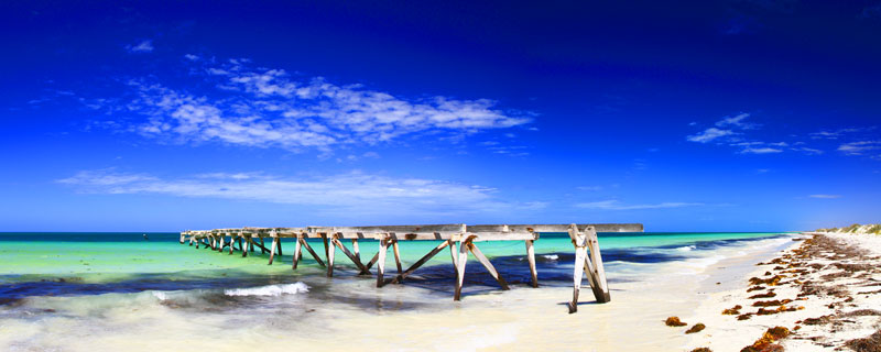
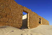
Crossing the border into Western Australia the cliffs finally give way to vast dunes and blinding white sandy beaches. We visited the ruins of the old telegraph station and jetty at Eucla. This area really gave me a sense of the region's history and isolation. The telegraph station was opened in 1877 to link the East and West of this vast continent. It now stands in ruin, slowly sinking beneath the drifting sands.
 |
|
Eucla Telegraph Station |
Our journey now broadens out into Australia’s largest state, Western Australia.
To read about the next leg of our journey, see new links on our Big Trip Homepage or receive notification via our newsletter subscription (bottom of our home page).